
Groundwater Elevation
This category is dependent on selection of the Link to MODFLOW 2000 RIP ET method in the Groundwater Computation category; see Link to MODFLOW 2000 RIP ET. This category should be used in conjunction with the “Groundwater Lateral Flux” category on which a method other than “None” should be selected.
This is the default method. There are no slots associated with this method.
Note: RiverWare’s connection with MODFLOW is currently not functional. This method has been disabled and cannot be selected. An error will be posted at model load if this method was previously selected. Contact CADSWES for help.
This method calculates an head (elevation) for each of the MODFLOW cells specified by the user in the GroundWater Elevation Upstream Map and GroundWater Elevation Downstream Map slots using a weighted interpolation. An individual cell head is interpolated from between two GroundWater object’s heads (elevations) (GroundWater Storage.Elevation) and set in the GroundWater Elevation to MODFLOW slot. The calculated elevation for each cell in the GroundWater Elevation to MODFLOW slot is transferred to MODFLOW. SeeMethod Details for the interpolation equation. The GroundWater Elevation Upstream Map and GroundWater Elevation Downstream Map slots should contain the same list of MODFLOW cells.
Slots Specific to This Method
GroundWater Elevation Upstream Map
Type: Table slot
Units: No units
Description: Maps a MODFLOW cell to a GroundWater Storage object specified on the subbasin
Information: The layer, row, and column of each MODFLOW GHB cell is input by the user and the corresponding upstream GroundWater Storage object needs to be set as the row title. Interpolation weights corresponding to the upstream GroundWater Storage object also need to be input. The sum of the Upstream Elevation Weight and Downstream Elevation Weight for a single cell should add up to 1.
I/O: Input only
Links: Not linkable
Layer | Row | Column | Upstream Elevation Weight | |
|---|---|---|---|---|
GW 1 | 1 | 1 | 1 | 0.7 |
GW 1 | 1 | 2 | 1 | 0.5 |
GW 2 | 1 | 6 | 1 | 0.4 |
GW 2 | 1 | 7 | 1 | 0.2 |
GroundWater Elevation Downstream Map
Type: Table slot
Units: No units
Description: Maps a MODFLOW cell to a GroundWater Storage object specified on the subbasin
Information: The layer, row, and column of each MODFLOW GHB cell is input by the user and the corresponding downstream GroundWater Storage object needs to be set as the row title. Interpolation weights corresponding to the downstream GroundWater Storage object also need to be input. The sum of the Upstream Elevation Weight and Downstream Elevation Weight for a single cell should add up to 1.
I/O: Input only
Links: Not linkable
Layer | Row | Column | Downstream Elevation Weight | |
|---|---|---|---|---|
GW 1 | 1 | 1 | 1 | 0.3 |
GW 1 | 1 | 2 | 1 | 0.5 |
GW 2 | 1 | 6 | 1 | 0.6 |
GW 2 | 1 | 7 | 1 | 0.8 |
GroundWater Elevation to MODFLOW
Type: Table Series slot
Units: Length
Description: Interpolated elevation (head) value for each MODFLOW cell as specified in the GroundWater Elevation Upstream Map and GroundWater Elevation Downstream Map slots. Value for each corresponding MODFLOW cell is interpolated between the Upstream and Downstream GroundWater objects. The column labels are automatically defined at the beginning of the run, in MODFLOW initialization. The user unit configuration (m, ft, and so on) selected on this slot must match with the units used in MODFLOW.
Information: Transferred to MODFLOW
I/O: Output only
Links: Not linkable
Method Details
Figure 8.5 Groundwater elevation head interpolation calculation
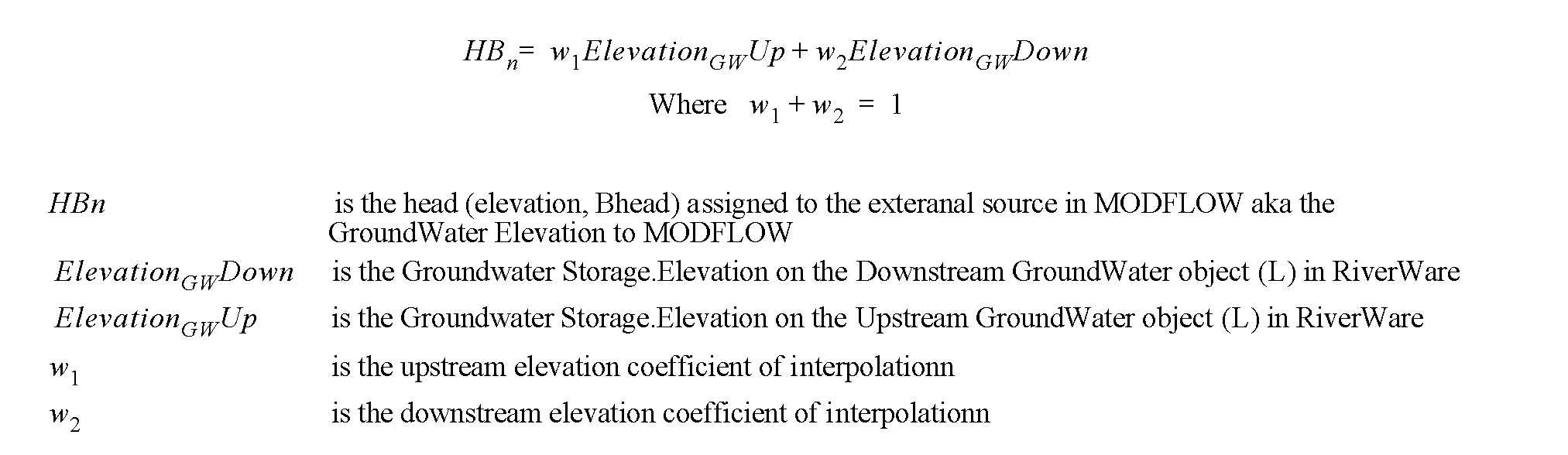
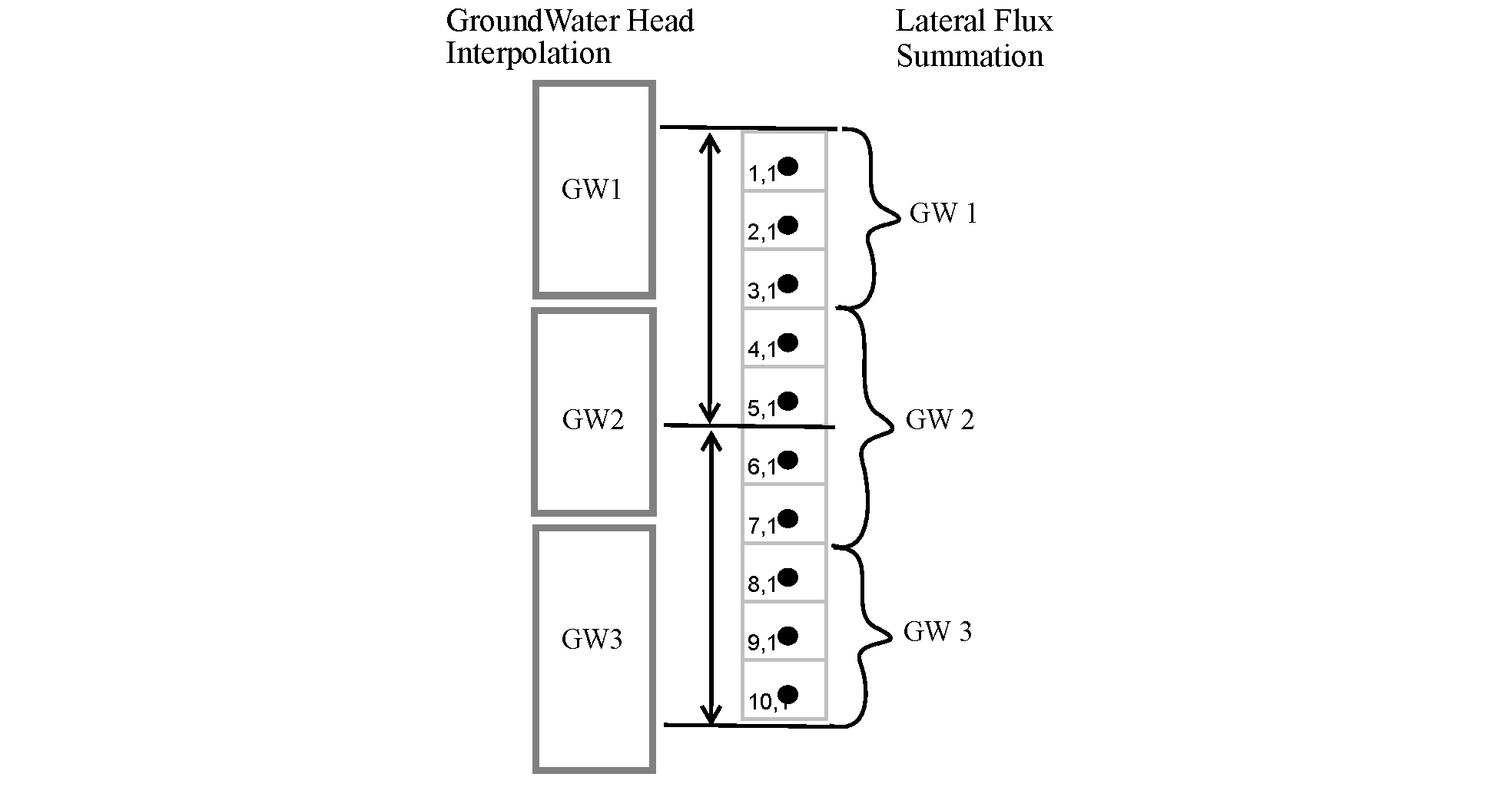
Figure 8.6 Example mapping of MODFLOW cells to groundwater storage objects for interpolation and summation
Revised: 01/04/2021